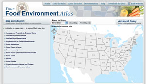
 If you are concerned with health and what Americans are eating, you have got to check out the Food Environment Atlas. Announced by Michelle Obama, this tool can be used as part of her stand against childhood obesity. The interactive Food Environment Atlas provides data in a visual map that illustrates the environment that we have created, how we eat, and how we exercise.
I took a look at Indiana, selected different factors to explore from availability of restaurants and how much we spend on fast food to food taxes and the percentage of high schoolers who are physically active, and saw county by county how we rate and how we compare to neighboring states.
I make the farmer’s market a part of my regular routine; however, it looks like approximately a third of Indiana counties do not have a single farmers market and only Marion county (Indianapolis) has more than five. I am spoiled to be able to walk to one each week. No longer will I complain when my schedule requires I visit the farmer’s market in another area of town. Beyond thankfulness, the data also made me realize that many of my DietsInReview.com readers may not be able to relate to me writing about that area of my life and how I keep my diet healthy.
The Food Environment Atlas in itself could spark many more topics about which we could write. As a blogger, it can give me more information about my audience and more data for my articles. The data has been drawn from many sources and makes many facts and stats easier to find. It is informative, easy to use, and fun too. Check it out and let us know how you will use this new tool.
